
Fortress of St. Elizabeth
From the air, the shape gives it away: a six-pointed star pressed into the earth of Kropyvnytskyi, its bastions and ditches drawn with geometric precision no natural landscape would allow. Fewer than ten fortresses of this type survive anywhere in Europe, and this one guards the heart of the very city it created. Locals call it, simply, the earthworks. Its outline became the city's coat of arms. But for all its military design, the Fortress of St. Elizabeth fired on an enemy exactly once in its long life - and the wars it truly witnessed came from within.
A Star Raised by Cossack Hands
In 1752, Empress Elizabeth of Russia signed a decree creating a settlement called New Serbia on lands that had belonged to the Ukrainian Cossacks, resettling Serbian soldiers to guard the southern frontier against raids. The fortress meant to shield them was named for the empress. The labor fell to the Cossacks themselves: a regiment of some 1,390 men from Hadiach and Myrhorod arrived in 1754 and completed the main earthworks in roughly four months. The cost of that speed is recorded plainly - 72 died, 233 fell ill, and 855 simply walked away. Within the ramparts rose a full town, centered on the wooden Holy Trinity Church, with barracks for over two thousand soldiers, powder cellars, and the houses of commanders and clergy. The guns numbered in the dozens, waiting.
The Last Raid
The waiting ended in January 1769. During the Russo-Turkish War, the Crimean khan Qirim Giray led an army said to number 70,000 across the frontier and halted near the fortress, where General Isakov sheltered with his garrison and the townspeople who had fled inside. The raiders plundered the surrounding villages and carried off local people into slavery - the fate that had haunted these plains for generations, when the Crimean and Nogai raids swept the borderlands. But the walls held. The defenders repelled the assaults and drove the army off. It was, as it turned out, the last such raid the Crimean Tatars would ever launch into Ukraine. The fortress never fought again. Its guns were slowly carted away to Kherson, and by 1805 its military status was formally erased, leaving only two cannons on stone pedestals at the old main gate.
A House of Learning, Then of Grief
Stripped of its guns, the fortress became something stranger and more useful. A school for officers' children opened here in 1763; the following year, Ukraine's first civilian printing press was founded within the walls. Grigory Potemkin established one of the country's earliest medical schools here in the 1780s, and the great surgeon Nikolay Pirogov later worked in its hospital during the Crimean War. For a century the ramparts sheltered classrooms and wards rather than soldiers. Then the twentieth century arrived, and the fortress kept darker company. The Bolsheviks jailed political opponents in it. During the Holodomor famine of 1932 and 1933 and the Great Purge, secret police buried those they had killed in mass graves on these grounds. A memorial now marks the 2,238 residents the city lost to the famine.
What the Earthworks Remember
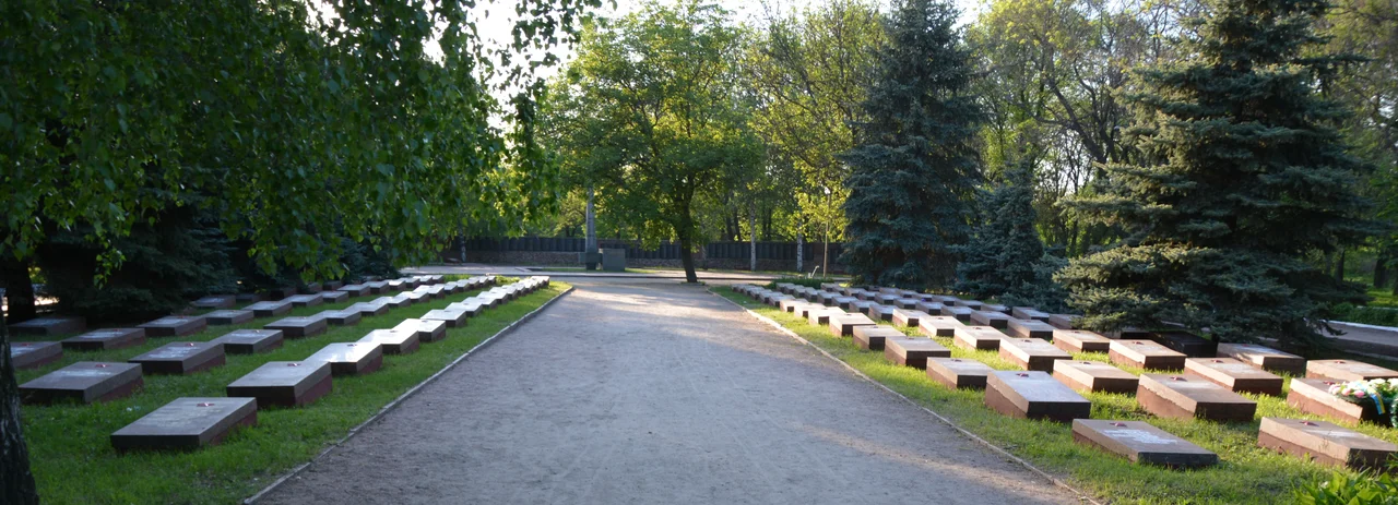
Today roughly 85 percent of the fortress structures survive - the bastions, most of the ravelins, the escarpments and curtains and sloping glacis all still legible in the turf, though weathered and long overdue for care. The grounds hold two hospitals dating to 1800, a Soviet-era memorial cemetery, and, since 2014, an alley of memory for the soldiers of the ongoing war. Proposals to encase the ancient earthworks in concrete have been raised and, wisely, set aside. To stand on the ramparts now is to stand on a single hill that has carried nearly three centuries of a borderland's story - built by Cossacks, defended once, and thereafter a witness to almost everything else that came.
From the Air
The Fortress of St. Elizabeth lies at 48.498N, 32.254E, within the city of Kropyvnytskyi in central Ukraine. Its six-pointed star of green earthworks is best appreciated from directly overhead at 2,000 to 3,500 feet, standing out against the surrounding urban grid. The nearest airport is Kropyvnytskyi (UKKG).
Nearby Stories
- Melgunov Kurgan 16 km away
- Granite-Steppe Lands of Buh 51 km away
- Church of the Nativity of the Theotokos 55 km away
- Battle of Kurukov Lake (1625) 61 km away
- Yelanets Steppe Nature Reserve 62 km away
- Bug Gard National Nature Park 67 km away
- Maidanetske 70 km away
- Kryvbas 72 km away