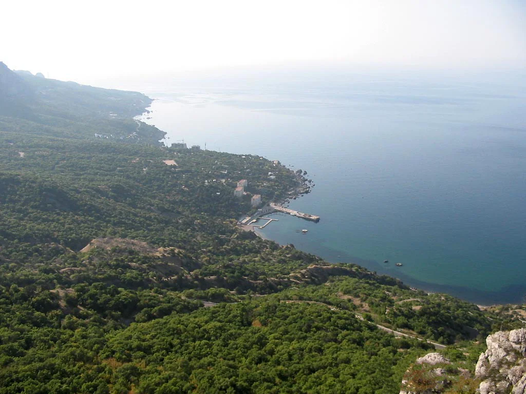
.jpg)
Cape Sarych
Stand at Cape Sarych and you are as far south as Crimea reaches, at the point where the peninsula's coast bends its final degree toward Turkey. The ancient Greeks who sailed these waters called it Kriou metopon, the "ram's forehead," and the name fits a blunt headland butting into open sea. From here the Black Sea pinches to its narrowest span: just 229 kilometers of water separate Sarych from Cape Kerempe on the Turkish shore. For centuries this has made the cape a crossroads and a chokepoint, a place ships must pass and navies have fought to control.
The Narrowest Water
Geography gives Cape Sarych its importance. It is the southern extremity of the Crimean Peninsula, a headland with the resort town of Foros five kilometers to the east, Sevastopol about thirty kilometers to the northwest, and Yalta some forty to the east. Because it reaches so far south, and because the Turkish coast juts north to meet it, the stretch of sea here is the tightest in the entire Black Sea. Any vessel crossing between the northern and southern shores is drawn toward this line, which is why the cape has served as a natural gate for trade and war alike, watched over in modern times by a lighthouse on its rocky point.
A Battle in the Mist
On 18 November 1914, early in the First World War, the Black Sea's importance turned violent off this headland. A Russian squadron of five pre-dreadnought battleships under Vice Admiral Andrei Eberhardt, led by the flagship Evstafi, met two of the fastest warships of the age: the battlecruiser Goeben and the light cruiser Breslau. Both had been sold to the Ottoman Empire and renamed Yavuz Sultan Selim and Midilli, yet both kept their German crews and their German commander, Rear-Admiral Wilhelm Souchon. The exchange was brief but bloody: Evstafi absorbed five hits, including a shell that tore into her bridge and left 34 dead and 24 wounded, while a blast near one of Goeben's 15-centimeter casemates killed thirteen of her crew. Souchon, unwilling to risk a modern ship the Ottomans could not properly repair, then used a heavy mist and his superior speed to break off and slip away.
The Contested Point
In quieter decades the cape's lighthouse became the object of its own long dispute. From 2005 the light on the headland was held by the Russian military even as a court in Sevastopol ruled it should return to Ukrainian control, and the ground around Sarych was closed off, ringed with barbed wire. The question was never fully settled before it was overtaken by the larger events of 2014. Beneath the arguments over who commands the point, the older truth persists: Sarych is simply the place where Crimea runs out of land, a ram's-forehead of rock facing the widest reach of open water toward a distant Turkish shore.
From the Air
Cape Sarych sits at 44.39 degrees north, 33.74 degrees east, the southernmost point of Crimea. From 4,000 to 6,000 feet the lighthouse on the headland and the nearby resort town of Foros to the east are the clearest landmarks, with the open Black Sea stretching south toward Turkey. The nearest airfields are Sevastopol's Belbek (UKFB) to the northwest and Simferopol (UKFF) inland.
Nearby Stories
- Charax, Crimea 5.1 km away
- Soviet Destroyer Otvazhny 11 km away
- Russian Battleship Ekaterina II 15 km away
- Chatyr-Dag 19 km away
- Battle of the Alma 22 km away
- Januarius MacGahan 324 km away
- Tottenham (1802 Indiaman) 356 km away
- Abkhazia 568 km away