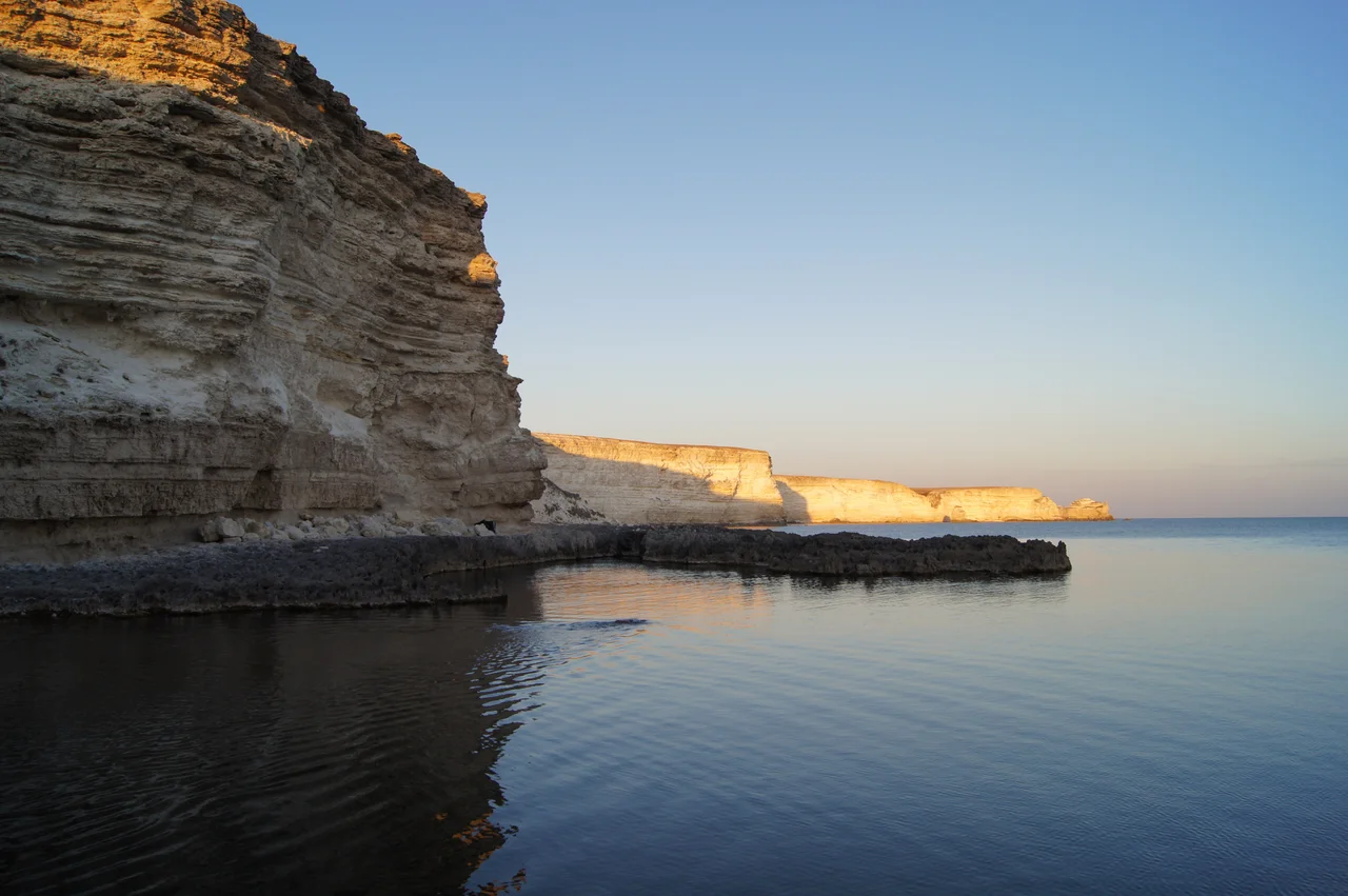

Tarkhankut Peninsula
Stand at the very tip of Cape Tarkhankut and there is nothing ahead of you but water, all the way to the horizon and beyond it to the Romanian coast you cannot see. This is where Crimea runs out. The peninsula narrows to a blunt limestone finger, its cliffs dropping in pale terraces to a sea so clear that divers come from across the region to hang weightless above submerged grottoes. A lighthouse marks the western edge, and the wind rarely stops, combing the thin steppe grass and driving the swell against the rock. Everything here feels like an ending and an edge at once, a place where the land seems to lean out over the sea and simply stop.
The Cape and Its Light
The peninsula's most famous point is Cape Tarkhankut, its southwestern tip, and the whitewashed Tarkhankut Lighthouse that stands watch there. It sits at the western edge of Crimea, near Cape Prybiynyi, the peninsula's true westernmost point, a place where the coastline finally exhausts itself against the open Black Sea. For sailors, the light has long marked the edge of the land, a fixed point in an expanse of water that stretches uninterrupted toward the horizon. The cape gathers everything that makes the peninsula distinctive into a single dramatic promontory: the pale limestone, the constant wind, the sense of standing at the very margin of the map. It is the kind of place people travel to precisely because there is nothing beyond it, only sea and sky meeting somewhere far out of reach.
Where the Land Runs Dry
The Tarkhankut Highlands are not mountains so much as a raised, sun-bleached tableland, a low upland of pale stone and thin steppe grass that tilts gradually toward the coast before breaking off in cliffs. Rain is scarce here, and the land shows it: parched in high summer, the color of bone and straw. The northern shore forms the southern edge of Karkinit Bay, a broad, shallow arm of the Black Sea. To the south lies Donuzlav, a long, narrow salt lake linked to the sea by a ship channel cut through the land. Wind farms turn near its shores, their blades wheeling in the constant coastal air, harvesting the one resource this exposed peninsula has in endless supply. It is a landscape stripped to essentials, treeless and open to the sky, and much of its beauty comes from that very austerity, from the clean lines of stone meeting water with nothing in between.
The Water Below
What draws people to Tarkhankut is not the land at all but what lies beneath its cliffs. The water off this coast is famously transparent, and the limestone has been sculpted by the sea into arches, tunnels, and underwater galleries. Snorkelers and divers explore grottoes where sunlight filters down through impossibly blue water and the rock opens into hidden chambers. Along the shore, waves have carved the soft stone into natural bridges and pillars, so that the coastline reads like a ruin built by no one. For a peninsula this dry and quiet above the waterline, the sea holds an unexpected abundance of texture and light.
An Edge Under Watch
Tarkhankut's position at the western extremity of Crimea has always given it strategic weight, and in recent years that geography has drawn the pressures of the wider Russo-Ukrainian War onto its quiet cliffs. Military installations were placed here, including a radio-engineering regiment and, for a time, an S-400 air-defense missile system positioned to watch the sea and sky. On August 23, 2023, that missile site was reported destroyed in a Ukrainian strike. The peninsula's stark beauty and its usefulness as a lookout have never been separable, and the same wind-scoured emptiness that appeals to divers and photographers has long recommended it to those who need to see a long way in every direction.
From the Air
The Tarkhankut Peninsula sits at 45.42°N, 32.67°E, forming Crimea's western tip. A viewing altitude of 4,000–6,000 feet reveals the pale cliffs at Cape Tarkhankut, the Tarkhankut Lighthouse at the western edge, and the long narrow slot of Donuzlav lake to the south. The nearest airport is Saky (UKFI) to the southeast; Simferopol International (UKFF) lies further inland.
Nearby Stories
- Karkinit Bay 13 km away
- Pluton (complex) 16 km away
- Soviet Cruiser Chervona Ukraina 17 km away
- National Space Facilities Control and Test Center 26 km away
- SS Santa Fé (1921) 60 km away
- Tendra Spit 66 km away
- Black Sea Biosphere Reserve 96 km away
- Januarius MacGahan 378 km away